


Voting District 0036082000001, Alger County, Michigan
About
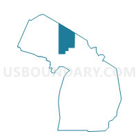
Outline

Summary
| Unique Area Identifier | 595768 |
| Name | Voting District 0036082000001 |
| County | Alger County |
| State | Michigan |
| Area (square miles) | 88.75 |
| Land Area (square miles) | 87.73 |
| Water Area (square miles) | 1.02 |
| % of Land Area | 98.85 |
| % of Water Area | 1.15 |
| Latitude of the Internal Point | 46.43352060 |
| Longtitude of the Internal Point | -87.02458570 |
Maps


Graphs
Select a template below for downloading or customizing gragh for Voting District 0036082000001, Alger County, Michigan


Neighbors
Neighoring Voting District (by Name) Neighboring Voting District on the Map
- Voting District 0030446000001, Alger County, MI
- Voting District 0036916000001, Alger County, MI
- Voting District 1031566000002, Marquette County, MI
- Voting District 1037411000001, Marquette County, MI
- Voting Districts not defined, Marquette County, MI
- ZZZZZZ, Alger County, MI
Top 10 Neighboring County Subdivision (by Population) Neighboring County Subdivision on the Map
- Chocolay charter township, Marquette County, MI (5,903)
- Rock River township, Alger County, MI (1,212)
- Au Train township, Alger County, MI (1,138)
- Skandia township, Marquette County, MI (826)
- Onota township, Alger County, MI (352)
- County subdivisions not defined, Marquette County, MI (0)
Top 10 Neighboring Elementary School District (by Population) Neighboring Elementary School District on the Map
Top 10 Neighboring Unified School District (by Population) Neighboring Unified School District on the Map
- Marquette Area Public Schools, MI (32,158)
- Gwinn Area Community Schools, MI (9,903)
- Superior Central Schools, MI (2,226)
Top 10 Neighboring State Legislative District Lower Chamber (by Population) Neighboring State Legislative District Lower Chamber on the Map
Top 10 Neighboring State Legislative District Upper Chamber (by Population) Neighboring State Legislative District Upper Chamber on the Map
Top 10 Neighboring 111th Congressional District (by Population) Neighboring 111th Congressional District on the Map
Top 10 Neighboring Census Tract (by Population) Neighboring Census Tract on the Map
- Census Tract 12, Marquette County, MI (5,565)
- Census Tract 2, Alger County, MI (2,742)
- Census Tract 11, Marquette County, MI (1,565)
Top 10 Neighboring 5-Digit ZIP Code Tabulation Area (by Population) Neighboring 5-Digit ZIP Code Tabulation Area on the Map
- 49855, MI (33,561)
- 49885, MI (1,897)
- 49816, MI (724)
- 49806, MI (627)
- 49825, MI (299)
- 49822, MI (220)
- 49826, MI (137)